|
The term "Naco Group" has been used in the past to primarily describe a series of six formations in Southeastern Arizona ranging from Virgilian Pennsylvanian in age up to Leonardian aged Permian Strata. From ascending order they are the Pennsylvanian Horquilla formation and Earp formations, and overlain by the Permian Colina Limestone, Epitaph, Scherrer and Concha formations. We will be concerning ourselves here only with the Southern Pennsylvanian Horquilla and Earp formations of the Naco Group. The predominant Pennsylvanian formation over much of southern Arizona is the Horquilla formation. It is Early Virgilian in age, and is typically 1000 to 1800 feet thick, consisting of highly clastic limestone beds, with little shale or sandstones. It also includes a large amount of bedded red chert, some beds up to tens of feet thick. It is highly fossiliferous and seems to have no exact lithologic equivalent on the Mogollon Rim. The overlying Earp formation, of Virgilian to early Wolfcampian aged is thinner, and consists of interbedded shaly limestone, laminated dolomites, reddish shales and sandstones. The contact between the Horquilla and Earp occur at the point where the shales become dominant over the limestones of the Horquilla. The Earp is also highly fossiliferous, and has been mostly correlated with the members of the Naco Formation on the Mogollon Rim. Fossils in the Naco Group include clear water shallow marine basin fauna such as bryozoans, rugose and tabulate corals, brachiopods, cephalopod and some mollusks, fish material, trilobites, echinoids, enchinoderms. Many localities have a unique preservation of red chertized fossils in pure low terrigenous content limestones. Commonly found are red chertized crinoid calyxes, Composita brachiopods, and plates and spines of sea urchins.
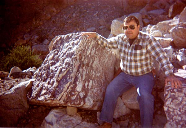
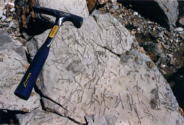
A predominant marker bed in the Horquilla is the purple tinted trace fossil beds. Here, a friend Vince Mele sits next to a boulder that contains the flattened large burrows, some up to three inches in diameter. The animal responsible for these burrows is probably some form of shrimp like arthropod. This site is near Winklemann.
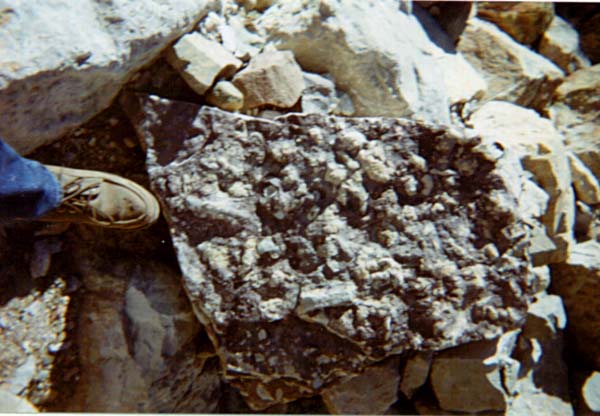
Close up at Winkelmann of the burrow bed. Notice the highly three dimensional relief of the bed, many showing scratch marks and digs of the unseen animal.
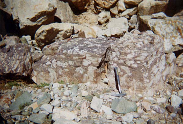
Side view of the burrow bed at Winkelmann. The trace fossils are flattened nearly 2:1, some being as large around as your wrist.
The gorgeous Horquilla limestone cliffs in the Winkelmann - Hayden area. Many thin and thick beds of purely clastic limestones are interbedded with bright red and orange cherts - the remains of glass sponges primarily.
Hiking into the Horquilla formation near Winkelmann. The variable thickness of the bedding can be seen here, many of the upper surfaces were highly fossiliferous containing an abundant fauna of red chertized brachiopods and crinoids.
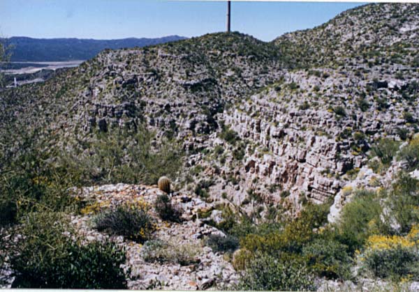
Exploring the Horquilla formation near Winkelmann. Note the gorgeous bedding of the distant hill, the limestones are highly contorted in this area, changing as the result of ground movements over the eons.
Over view of the Naco Group from the Hayden-Winkelmann area from the top of a tall ridge. Numerous bryozoan beds were found here, the limestone consisted almost entirely of them, both branching and fenestrate types were represented.
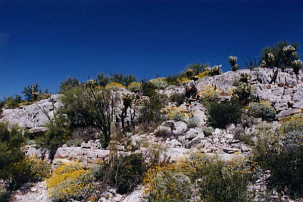
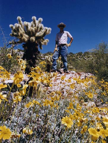
I've included this one as a show of the desert plant faunal assemblage we found in the Hayden area growing in the Horquilla Formation.
Massive branching bryozoan beds found athe top of the ridges near Winkelmann. The limestones of the Naco contain both silicified and calcified fossils such as seen here.
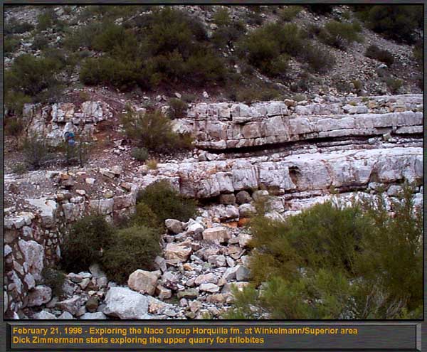
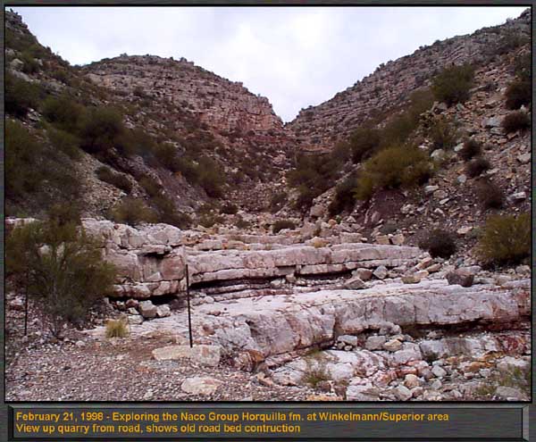
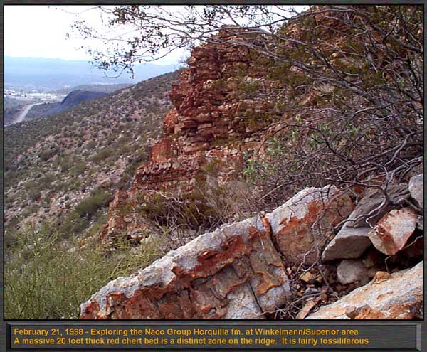
The Author stands on top of a block of limestone with interbedded red cherts, so predominant in the Horquilla and Earp formations. This was in the Winkelmann - Hayden area in the spring when all the cactuses were blooming! We continued our quest to get better images of the Horquilla Formation strata near Winkelmann. The site is located one mile north of the Highway 177 and 77 intersection. These brand new images, were taken in February 1998 with our newest digital camera, the Kodak DC120. The results are much sharper than scanned prints as the previous page showed, and more clearly show the intricate details of this areas fantastic Pennsylvanian Geology.
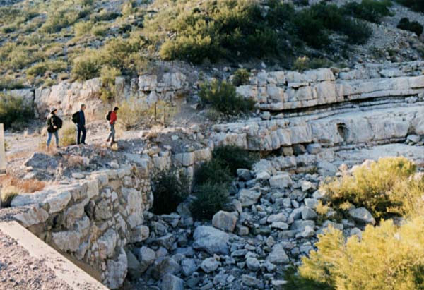
The main locality consists of thick and thin beds of limestone and hard dolomite. This is a water cut canyon, extending up into the hills, exposing some highly fossiliferous layers with mainly red chertized brachiopods such as Composita and Spirifer at the bottom, and up hill more conventional type preservation of calcified fossils in the limestones.
The stair steps are about 6 feet tall in this view of the main locality, a wash from the higher hills eroding the Naco. Note the massive limestones are interbedded with a softer thinner shale, that wears down far more easily than the resistant, often dolomitetized limestones.
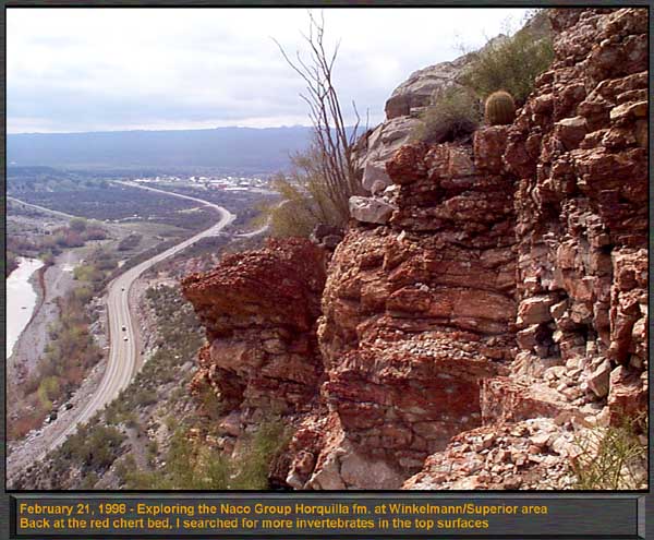
Several hundred feet up on the main slope, which is very steep and dangerous is a large reddish chert bed. About 10 to 20 feet thick, many of the upper surfaces are highly fossiliferous, containing the molds of invertebrates such as crinoids, bryozoans, corals and forams. The source of the chert is controversial, most sources indicate either direct precipitation from the seawater, or decaying glass sponges forming a silica ooze that filled cavities and low areas.
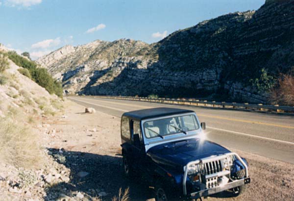
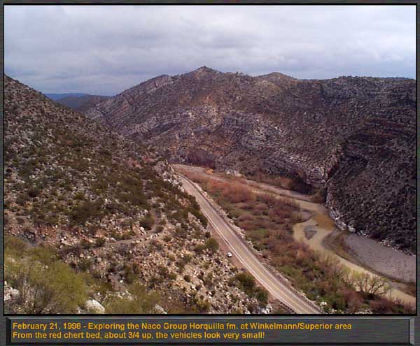
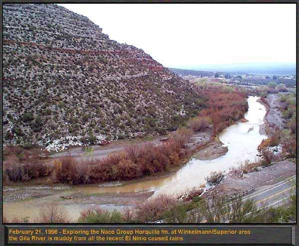
High up on the chert bed, the Gila River is small. Fantastic layering of the Horquilla Formation is evident, with a steep slope into the river. Look carefully, and you'll see our vehicles parked next to the roadway far below, the Zimmermans light blue bronco, and our dark blue Jeep Wrangler. Just above the vehicles, the old road bed, now almost completely eroded away is faintly visible.
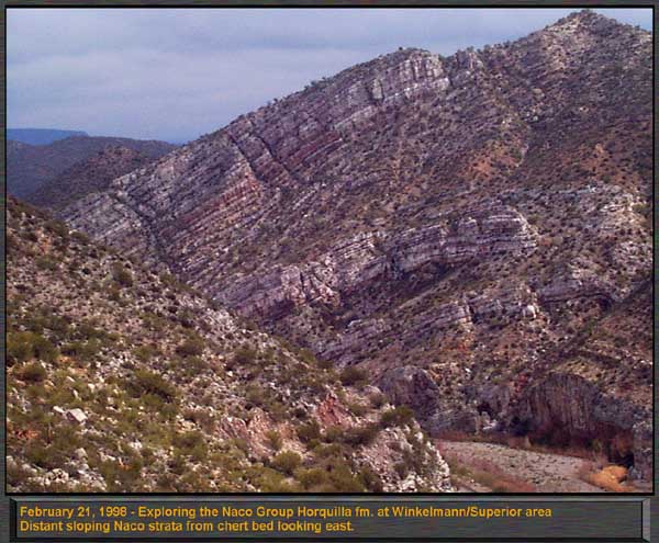
From high up in the chert bed, this telephoto view of the far canyon shows the countless layers in the Horqulla found here. The dark lines between the beds are plant material growing in the slope forming shales between the more resistant massive bedded limestones.
Another shot from the chert beds, showing just how steep and high up the unit is above the roadway. The cherts are often interbedded as well with limestones, that when exposed and eroded out form cavities in the cherts seen here.
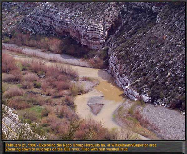
Zooming down to the Gila River from the Chert bed, shows the Horquilla Formation dipping strongly directly into the water. The river is what obviously eroded the canyon we are in, however it seems to have occurred by uplifting of the Naco strata as the river cut into it, rather than the river cutting down from the very top. This river seems to be a popular spot in the summer, as indicated by the distracting amount of graffiti sprayed all over the outcrops along the river.
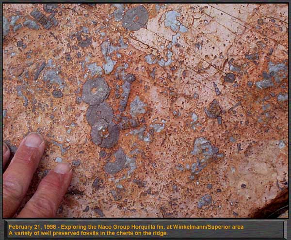
The top of the chert bed contains molds of invertebrates in massive abundance! This close up shows the surface of one chert layer that was very thin such that the underlying limestones wore through in some areas.
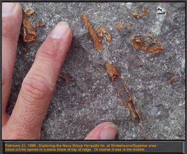
Although the preservation of these fossils is poor in the cherts, these urchin spines were found near the top well above the cherts. however the chertization process sometimes destroys delicate details. No loose urchin plates were ever found anywhere, so we suspect these are more mollusks than anything else.
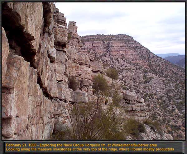
The very top of the ridge is a very steep climb by any standards and is not for the meek. The reward however is the fusilinid limestones forming thick beds. Excellent detail was seen in microscopic cross sections of this material, and as an added bonus, we found abundant gastropods in the same matrix, of the straparollus type.
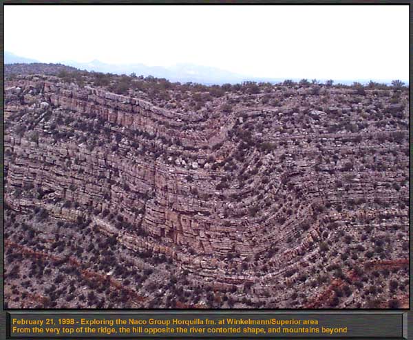
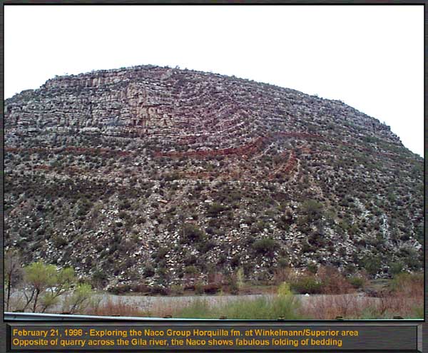
From the very top of the ridge, the opposite side of the river shows amazing folding and stress structures in the bedded Horquilla formation. Look closely at the bottom, and the reddish bed is the 20 foot thick chert bed I was in. Over the top we can see mountains in the distance with snow on them. Recall that the dark "shrubs" are full blown trees! This gives you some sort of scale here.
From down on the river, the ridges don't look so tall! But remember that the hill is leaning away from us, and is extremely foreshortened. The reddish chert bed is very prominent.
This is one of my favorite shots taken about 1/4 way up the ridge. The Gila River forms a large curing arc around the periphery of the formations, and catches all the debris from the top. Boulders and fines from the erosional process are carried downstream to form new sedimentary rock in the distant future. |